
The Paths
Five paths. 5.4 miles. One connected town.
Each path uses land that's already there: woods, brook edges, parks, and back lots. Some would be paved, some would be unpaved. All of them would let you get somewhere without walking along a major roadway.
All five, end to end
5.4 mi
- Paths
- 5
- Total length
- 5.4mi
- Walk them all
- 1hr 48min
- Paved / unpaved
- 3 / 2
North Wilmington Path
North WilmingtonThe Center
- Miles
- 1.3
- Minutes
- 27
- Surface
- Unpaved
Connects North Wilmington to the Center.
It starts at White Field, follows parts of Palmer Way and Douglas Ave, crosses Middlesex Ave, then runs along Middlesex Ave and Wildwood St past the library and Wildwood Cemetery. It ends near Wilmington High School at Adams St. A train station, a library, and a high school on one walk.
What's in the way
It passes a pond and wet ground near Lubbers Brook, so parts may need a boardwalk.
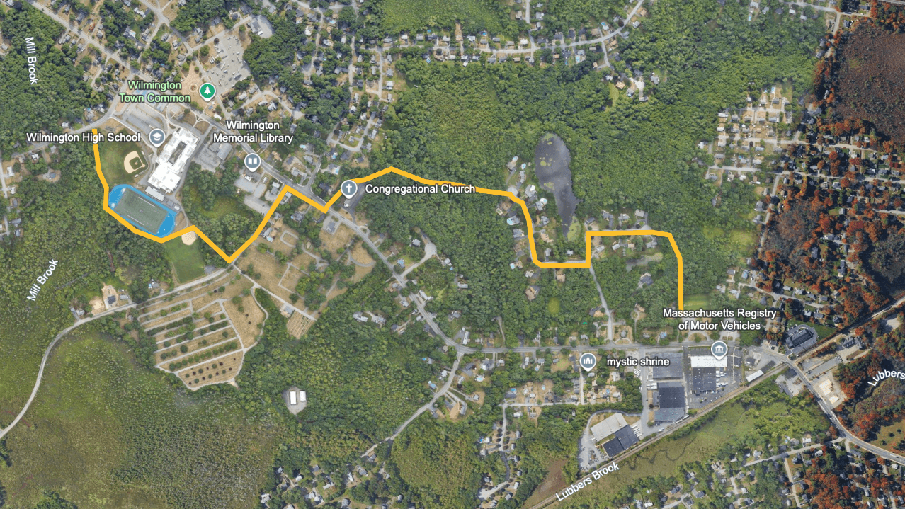
Drawn and measured in Google Earth. The small map shows where it sits among the five paths.
Main Street Path
Wilmington CrossingThe Center
- Miles
- 0.9
- Minutes
- 18
- Surface
- Paved
Connects Wilmington Crossing to the Center.
A widened sidewalk runs down Main Street from Wilmington Crossing, then turns onto Clark Street and ends at Church Street.
What's in the way
Route 38 traffic and a long run of plaza driveways. This is the only path that follows a major road, because there's no way around it.
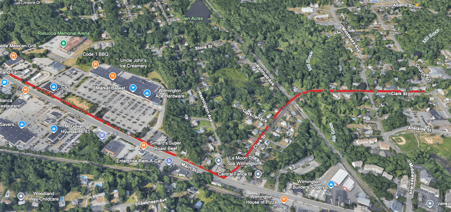
Drawn and measured in Google Earth. The small map shows where it sits among the five paths.
Rotary Park Connector
Center CrossroadsRotary Park trails
- Miles
- 0.3
- Minutes
- 6
- Surface
- Paved
Connects Center Crossroads to the Rotary Park trails.
It's the shortest of the five, but it puts a real trail network a few minutes from the commuter rail station. Allows pedestrians to avoid part of the busy Center Crossroads intersection.
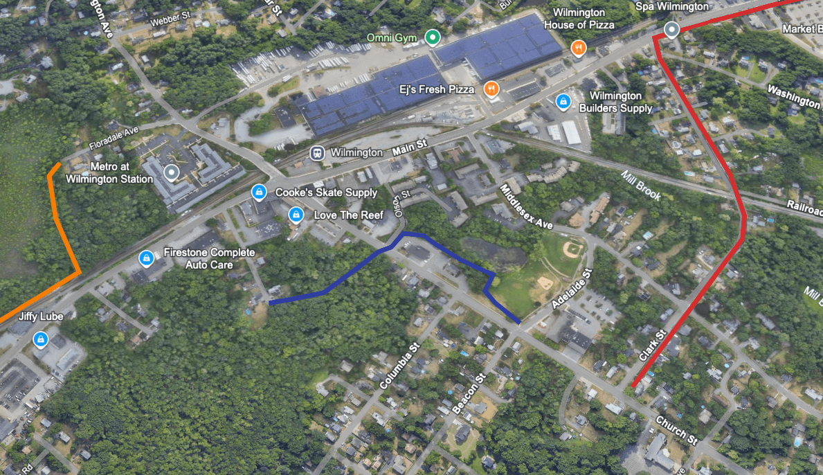
Drawn and measured in Google Earth. The small map shows where it sits among the five paths.
Butters Row Path
Center CrossroadsYentile Area
- Miles
- 0.8
- Minutes
- 17
- Surface
- Unpaved
Connects Center Crossroads to the Yentile Area.
It runs behind the commercial buildings off Main Street and comes out at Butters Row.
What's in the way
The path crosses land behind commercial lots, so the owners would need to be on board.
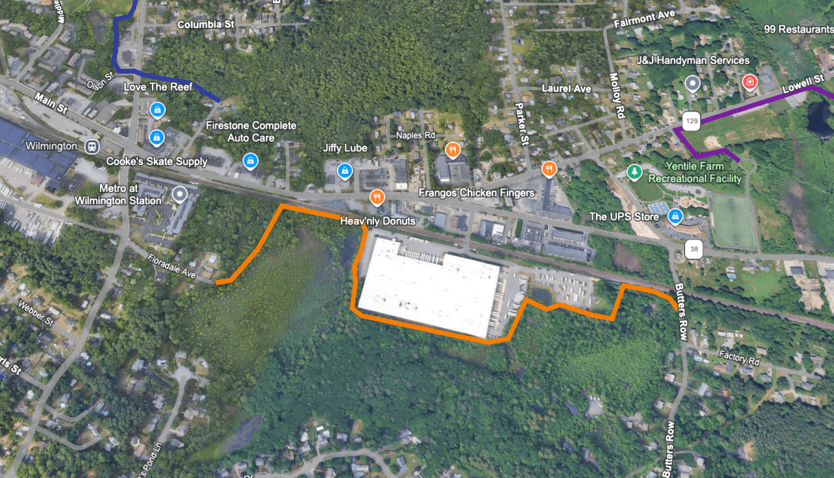
Drawn and measured in Google Earth. The small map shows where it sits among the five paths.
Yentile-East Path
Yentile AreaWest St. Cluster
- Miles
- 2.0
- Minutes
- 40
- Surface
- Paved
Connects the Yentile Area to the West St. Cluster.
The longest of the five, it starts at the Yentile Farm trail, loops south around the office and industrial campuses, crosses Woburn Street, and comes back up near West Street.
What's in the way
A Woburn Street crossing and private campus land. It stops at the West St. Cluster because the I-93 interchange just past it isn't walkable.
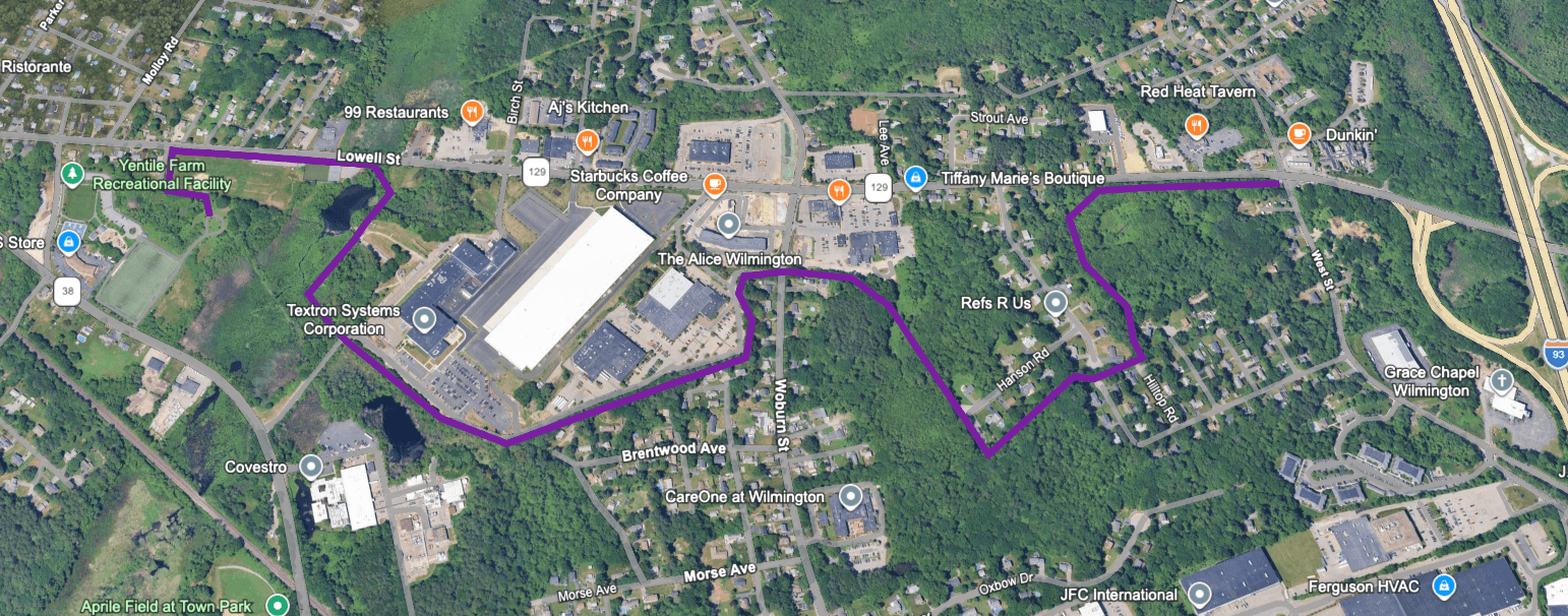
Drawn and measured in Google Earth. The small map shows where it sits among the five paths.
Linking the Five
Five paths, one chain.
Because the paths share hubs, the five already form one chain.
12North Wilmington Path and Main Street Path both end in the Center
34Rotary Park Connector and Butters Row Path both start at Center Crossroads
45Butters Row Path hands off to Yentile Path in the Yentile Area
The only gap: a short sidewalk link between the Center and Center Crossroads, which happens to be suitable for walking.
That turns five paths into one route, linking the major hubs of Wilmington together.